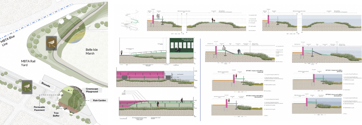


BELLE ISLE MARSH SITE PLAN
This project aims to maximize the natural resource of East Boston, Belle Isle Marsh, by increasing public access to nature and the waterfront, while protecting the marsh as a critical facility for East Boston. Our design principles are fourfold - Access to nature + waterfronts - Flood resiliency + minimizing damages - Protecting critical mobility facilities - Marsh restoration
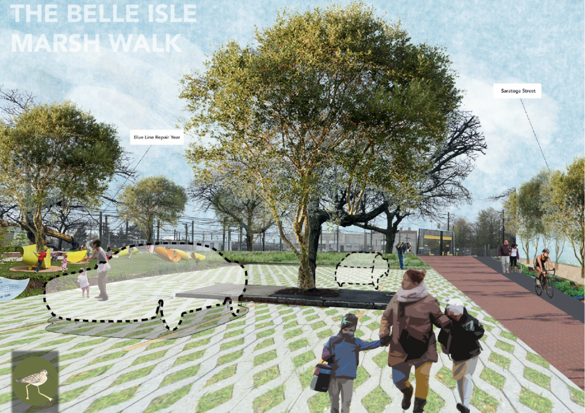
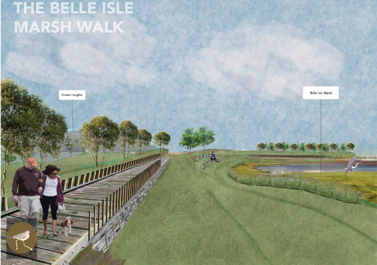
BELLE ISLE MARSH WALK
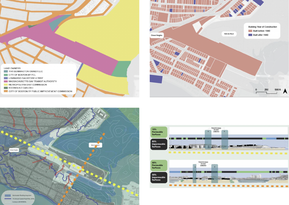
Analysis on current condition of Belle Isle Marsh
Site ownership and building age, environmental considerations, and current City of Boston initiatives were analyzed as a basis for site planning. Looking at site ownership, the City of Boston, Department of Conservation and Recreation, MBTA, Metropolitan dist commission, and Tobia Family (Bennington street owner) are the main owners in this area. Understanding ownership allows us to better understand the coordination necessary to put forward our plan. Building age was analyzed as an indicator of Flood risk. Plotted on a map, it was found that most of the houses were built before 1980. This suggests that the disaster risk of many homes in the area may not have been updated since that time. We also analyzed watersheds and stormwater runoff as one of the environmental considerations. This analysis indicates the precarious condition of the marsh toward the casket site and leads us to the key environmental consideration for our proposal, which is the coastal flood risk. Our cross sectional and plan view study shows the low permeability of this area and how marsh plays an important permeability role for the area.
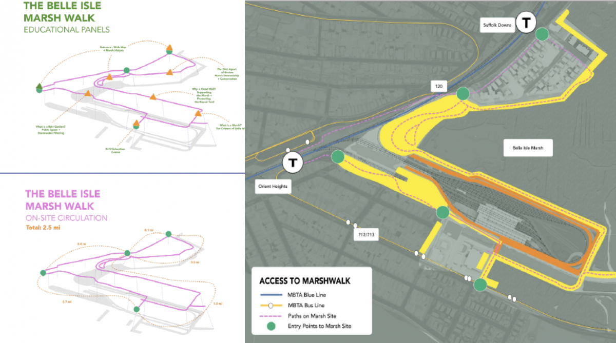
Circulation and Educational Panels for Pedestrians
Pedestrian circulation and Marsh entry points were considered, taking into account the MBTA Blue line and MBTA bus routes. At the same time, we also considered the location of educational panels to increase visitor understanding of Marsh and its educational benefits. The Site is located between Belle Isle Marsh, Saratoga Street, Orient Heights (T Stop) and Suffolk Downs (T Stop). There are two bus routes that operate in this site: - Bus 712/713 to Winthrop - Bus 120 to Maverick and Brandywyne Village Mobility around the marsh is intended to encourage East Boston community members and visitors from around Boston to not only gain access to the marsh, but also to learn about its essential role in protecting both human and non-human communities. Educational panels will include information about Marsh's history and current ecology, as well as a description of the rain gardens. The K12 Education Center will also be incorporated into the walking network to provide visitors with more detailed information about Marsh.
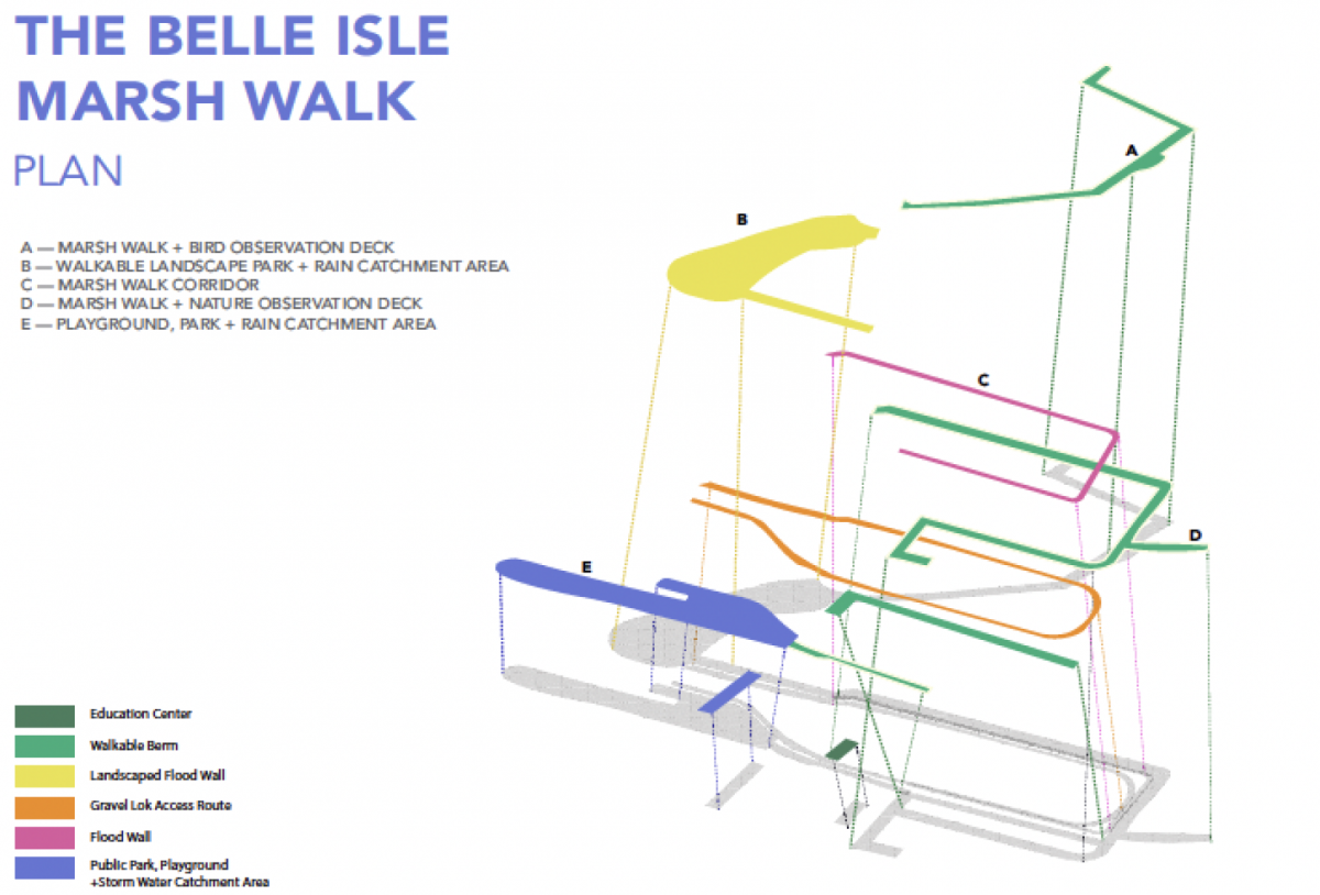
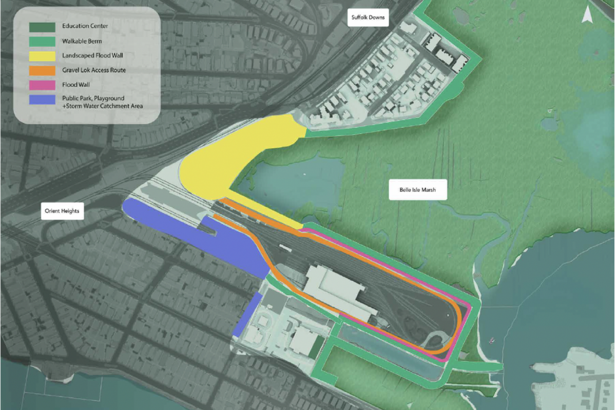
The Belle Isle Marsh Walk
Belle Isle Marsh Walk Plan is organized by education center, walkable berm, landscaped flood wall, Gravel Lok access route, flood wall, public park/playground + storm water catchment area. These elements create spaces like A. marsh walk + bird observation deck, B. walkable landscape park + rain catchment area, C. marsh walk corridor, D. marsh walk + nature observation deck, and E. playground & park + rain catchment area, that create interaction between people and the marsh. The design of these spaces was based on a series of cross-sectional studies and planned from various factors, including resilience in the event of flooding, interaction between Marsh and people, the relationship between the MBTA rail yard and Marsh, and environmental protection of Marsh. Flood risk is designed for both long- and near-term.
Site Plan