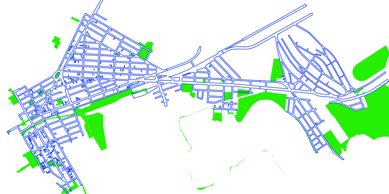
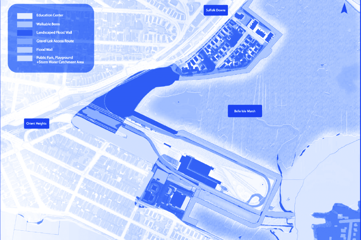
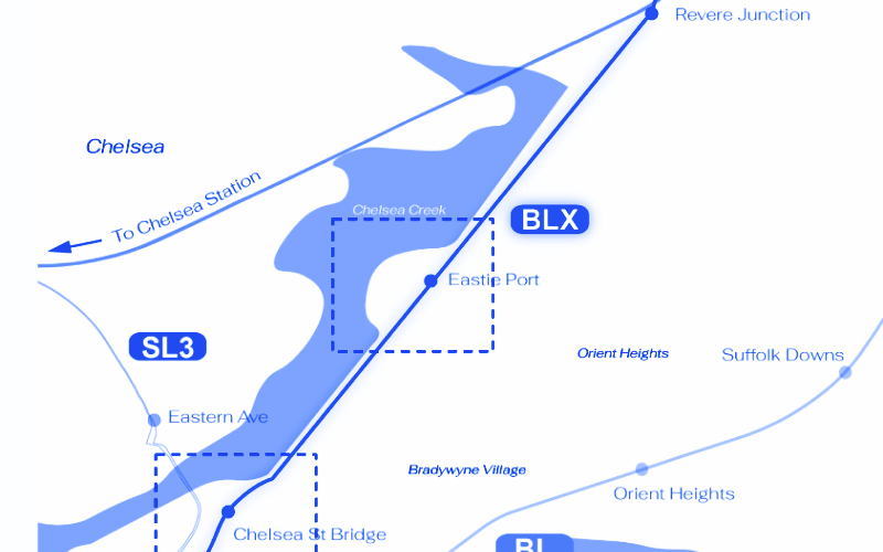
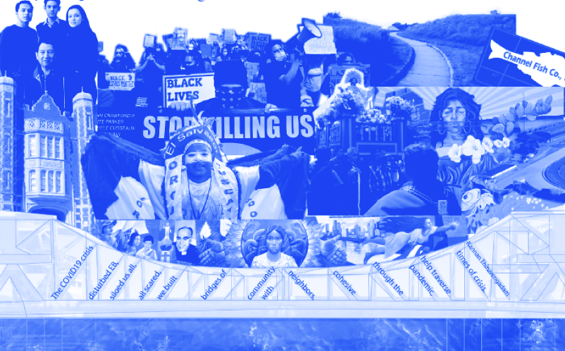
MIT students and community organizers are envisioning a resilient future for Eastie

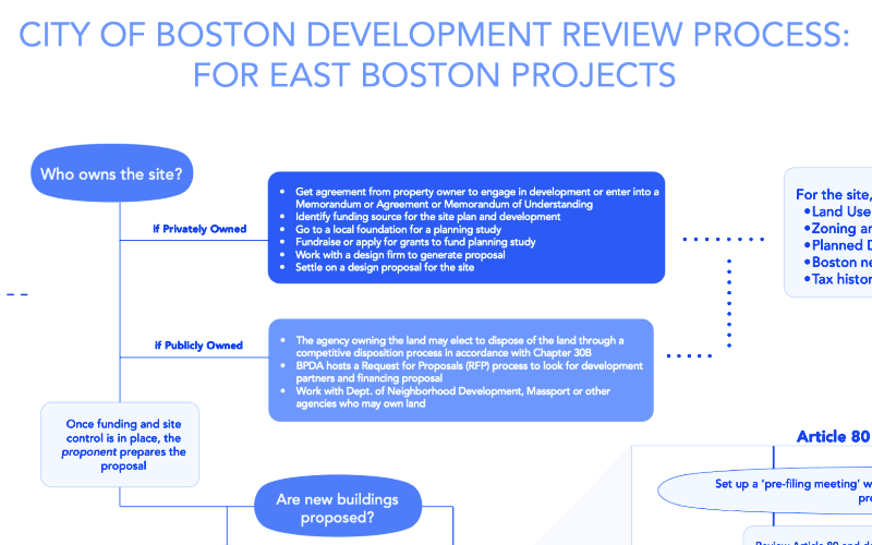
Over the course of three years, Masters students in the School of Architecture and Planning at MIT have worked with organizations in East Boston to research the neighborhood and create plans to address the challenges Eastie faces today. These plans consider how changes in the economy and climate are affecting East Boston and ways that the city, state, and community can take steps to help the neighborhood adapt to a changing world.

iconMain

Principles

Flood Mitigation

Nature Based Solution

Social & Environmental Justice

Land Ownership

Mobility

Education

Art & Culture

Housing

Urban Development

Projects

Projects

Belle Isle Marsh Resources

This pamphlet unfolds the political, ecological, and infrastructural histories of the Harbor View neighborhood waterfront. This foldout explores land ownership and its impact on the shape of the Belle Isle Marsh, the plants and animals that call the marsh home, and the way the natural environment engages with existing development. By reconnecting and reimagining the edge condition, the design suggestions provided in this document aim to make room for the marsh while addressing threats posed by climate change.

Belle Isle Marsh Edge

This project aims to maximize the natural resource of East Boston, Belle Isle Marsh, by increasing public access to nature and the waterfront, while protecting the marsh as a critical facility for East Boston. Our design principles are fourfold access to nature & waterfronts, flood resiliency & minimizing damages, protecting critical mobility facilities, and marsh restoration.

Haul Road

The Haul Road is an abandoned railroad right-of-way running along Chelsea Creek in East Boston. This right-of-way is currently the site of a proposed truck corridor from industrial properties along Chelsea Creek to Logan Airport, allowing airport freight trucks to bypass surface roads. However, this proposal also promises to increase vehicular traffic in East Boston and convert a public right-of-way into one controlled by a few companies. In this proposal, we reimagine the Haul Road as an extension of the MBTA’s Blue Line and envision how the expansion of a public transportation system can transform sites along its path.

Brandywyne Village

This project focuses on Brandywyne Village, one of the HUD apartments located in East Boston, and considers the future of the community from both physical and social perspectives. In this project, site planning is based on three themes: permeability measures that are highly feasible as short-term urban risk reduction measures, nature-based measures for long-term flood mitigation, and measures for density in consideration of affordability.

Storytelling in East Boston

This pamphlet explores storytelling’s role in envisioning a neighborhood’s future and different approaches to storytelling used by East Bostonians. Highlighting examples of community members and organizations that have made their narratives heard, the foldout aims to inspire current neighbors to engage with the history of the land, share their own stories and think about ways to foreground “community treasures” in Eastie.

Real Estate Development Toolkit

This pamphlet is one of four documents created by graduate students in the East Boston Site and Environmental Systems Practicum - Department of Urban Studies and Planning, MIT Spring 2021. These pamphlets can be read alone or together. They discuss East Boston’s power and decision making processes, offer storytelling as a way to understand East Boston’s past and future and propose new visions for Condor Street in Eagle Hill and Harbor View in the Belle Isle Marsh.

DPA Toolkit

Collaboration between local residents, the municipality, mission-driven developers, and industry, can transform DPAs from disinvested, contaminated, and partially abandoned sites into clean, adaptable sites for blue jobs and environmental justice. The toolkit contains strategies to inform that collaboration, and a possible Municipal Harbor Plan, with the hope that DPAs can become future community assets.

Flood Prevention Game

This is a kit to teach students about flooding in East Boston. Shorelines and waterfront areas are critical areas for flood mitigation and adaptation, and multiple interests exist in Condor Street and East Boston’s shoreline in general. This project focuses on educating young people and aims to promote their understanding of flood risks and measures to address them with a toolkit, as well as to create a space for them to express their aspirations.

Latino Futures for Condor Street

Come along with us as we unfold histories of resistance and solidarity on Condor Street in the Eagle Hill neighborhood. We hope that by exploring this industrial waterfront together, we can create a vision for spaces that welcome all.

Condor Street Redevelopment

This project applied a series of strategies outlined in the Designated Port Area (DPA) Toolkit to the waterfront along Condor Street in East Boston. This site was identified as an area where there is a need for improvements to facilitate public access to the waterfront and where current private uses are neither DPA-compliant nor serving the community. In this vision, a combination of industrial, civic, and recreational facilities operate within the DPA to enhance access to the waterfront for businesses and local residents.

Subscribe to Front page feed