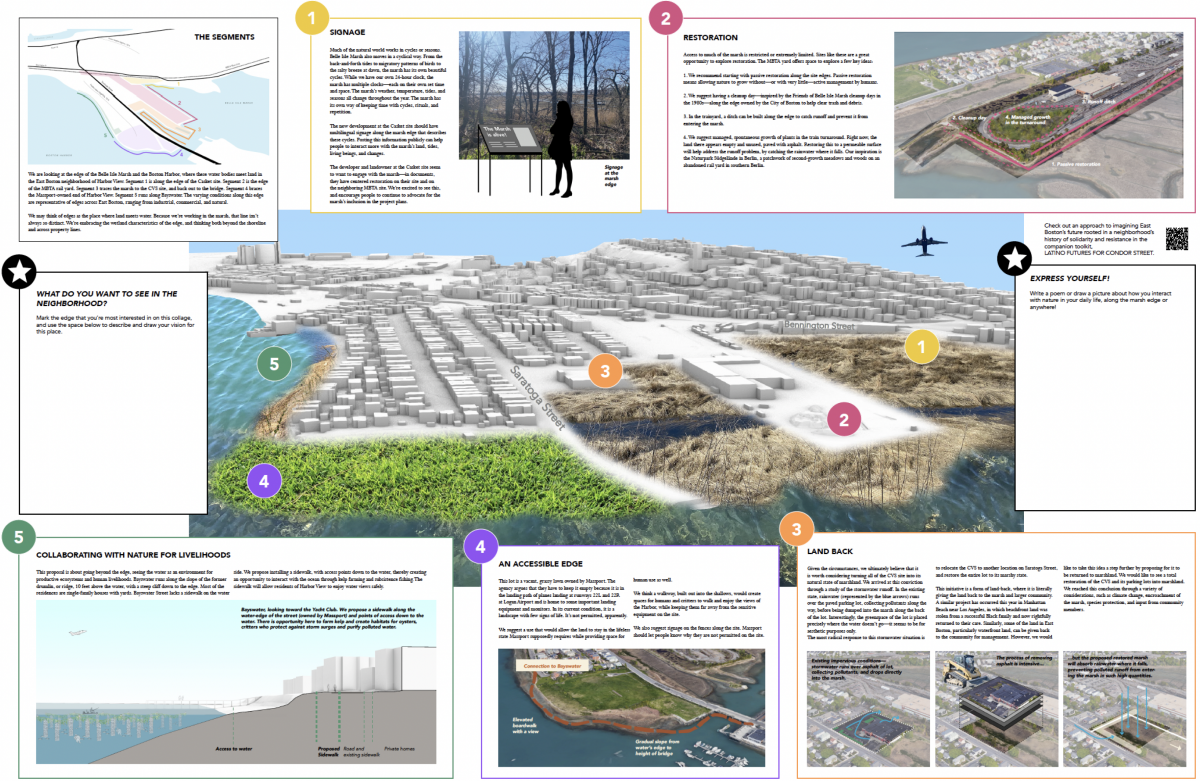


BELLE ISLE MARSH NATURAL RESOURCES
This pamphlet unfolds the political, ecological, and infrastructural histories of the Harbor View neighborhood waterfront. This foldout explores land ownership and its impact on the shape of the Belle Isle Marsh, the plants and animals that call the marsh home, and the way the natural environment engages with existing development. By reconnecting and reimagining the edge condition, the design suggestions provided in this document aim to make room for the marsh while addressing threats posed by climate change. This project responds to the existing and changing conditions of East Boston’s Belle Isle Marsh. The edges of the marsh are sites of conflict between nature and society—fault lines where tensions between human use and ecological use come into contact. With climate change and rising sea levels, the marsh is drowning. In order to make room for the marsh, this pamphlet contains proposals to help East Bostonians live in harmony with the marsh. Let’s start preparing now rather than later!
CRITTERS AND MAPS ALONG THE EDGE
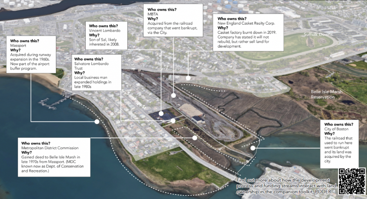
Who owns the land?
Land can be owned by various entities—not just individuals. These include corporations, city agencies, and public authorities. Each landowner will be involved in the planning process and regulated in different ways. It’s important to know who owns the land and why they own it. Asking “why”—and being able to answer it—is an empowering exercise that arms us with information that can be used in advocacy. To figure out who owns Harbor View and why requires looking at old maps and imagery to piece together the ownership story. The land that borders the Belle Isle Marsh is owned by Massport, the City of Boston, and by private landowners. Each of these landowners have different ways of implementing interventions on their properties. If we are going to propose something new for this land, it’s important to develop a flexible strategy that accounts for this fragmented ownership.
Marsh Encounters and the History of Belle Isle Marsh
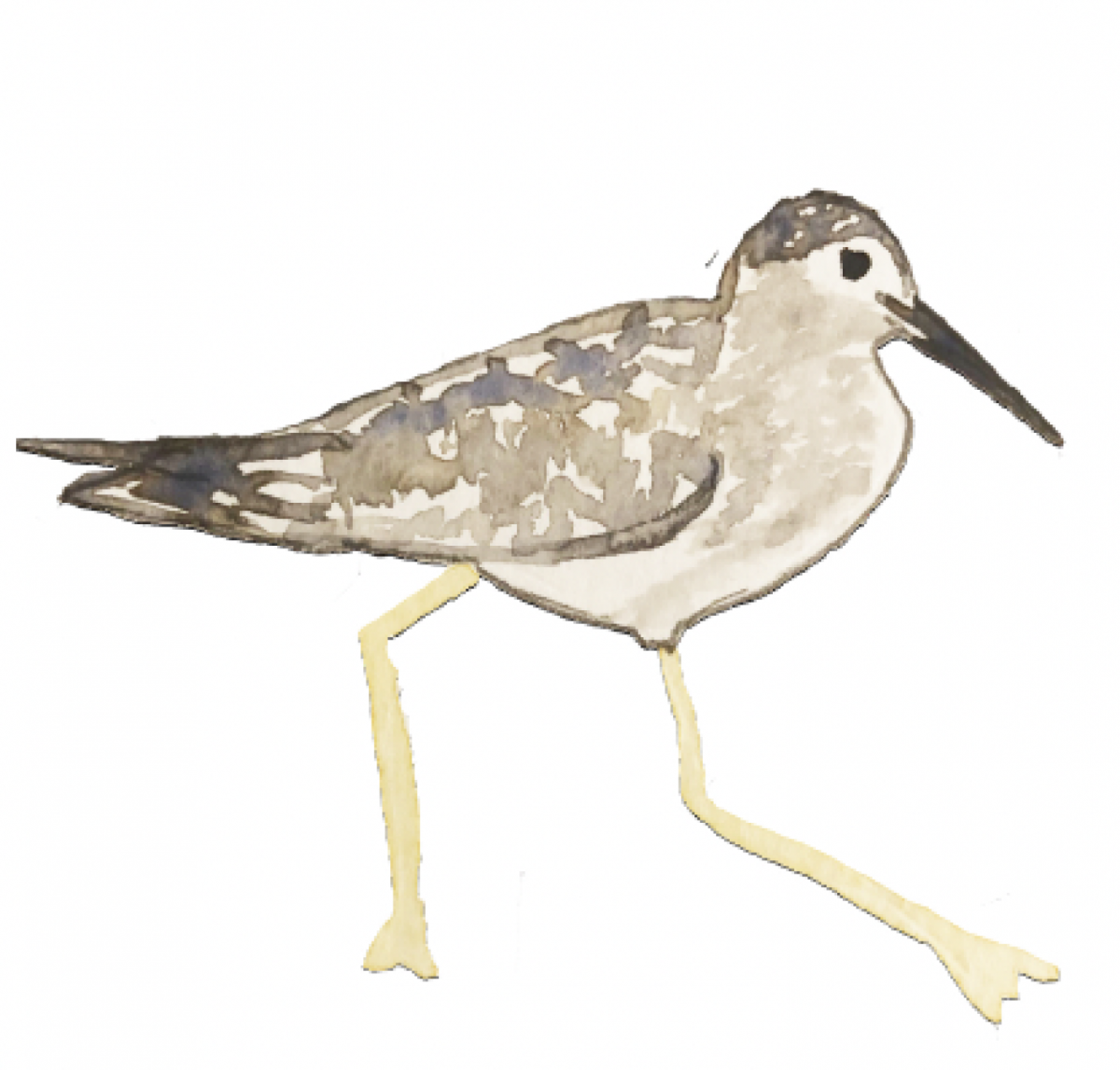
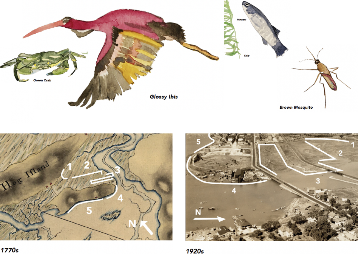
Belle Isle Marsh is alive! The humans of East Boston are neighbors to the non-humans of the marsh and greater landscape. The Green Crab is not native, but welcome and edible! The Brown Marsh Mosquito is a little pesky. The delicate Lesser Yellowlegs forage around with the small minnows; who bring in the mighty Glossy Ibis and Osprey. They remind us of the power of earth. We can pay attention to these critters, both the plants and animals to learn from their way of life. How do they move with the seasons? How do they build worlds? And what stories do they hold? Can we hold room for them in the physical landscape but also in our minds? The marsh already serves as a site for recreation for the people of East Boston. The marsh can do more. It can be a site for learning, healing and a place to earn an income. We can work with the marsh to unlock its full potential! We can also think of streets, lawns, and parking lots as the historic sites of animal and plant life. These can be sites for gardening and restoration, a chance to invite the natural world a little closer to our personal living spaces.
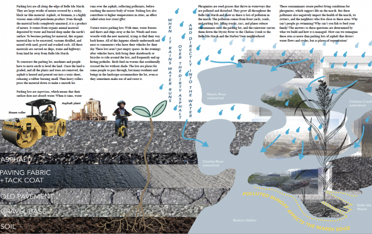
Permeability of Pavings
When it rains, water runs over the asphalt, collecting pollutants, before reaching the nearest body of water. Parking lots also contribute to higher temperatures in cities, an effect called urban heat island effect. Nature resists parking lots. With time, water freezes and thaws and chips away at the lot. Weeds and trees wrestle with the new material, trying to find their way back home. All of this happens silently underneath and next to commuters who leave their vehicles for their day. The pollution comes from front yards, roads, and parking lots. Idling trucks, cars, and planes release contaminants onto the parking lot, and the rainwater carries them down the Mystic River to the Chelsea Creek to the Belle Isle Marsh and the Harbor View neighborhood. These contaminants create perfect living conditions for phragmites, which support life on the marsh. But these pollutants also negatively impact the health of the marsh, its critters, and the neighbors who live close to these areas. Why can’t people go swimming? Why can’t you fish to feed your family? The answers to these questions are determined by what we build and how it is managed. How can we reimagine these sites as more than parking lots of asphalt that distort water flows and cycles, but as places of regeneration?
Massachusetts Interactive Property Map